Wedderburn Flood Management Plan
Draft mapping is now available for feedback!
Please find the report for download at the bottom of this page.
This report explains how data has been used to prepare the maps, along with the maps.
This mapping is the first step in better management and reduction of the flood risk in Wedderburn. Subsequent stages of the project will identify mitigation and emergency management responses.
State Planning Policy Clause 13.03 Floodplain Management requires Council to assist in the protection of life, property and community infrastructure from flood hazard by identifying land affected by flooding.
Please share your thoughts via the option below, or come along to the drop in session in the Council Chambers, Wedderburn, on Wednesday 17th June, 2026, anytime between 2pm and 6pm and have a chat to the consultants.
How is the mapping prepared?
Preparation of flood mapping is a highly specialist skill. The Wedderburn Flood Management Plan is being prepared by HARC (Hydrology and Risk Consulting). HARC have completed many flood studies, and are currently preparing the Rochester Flood Study as well as the Wedderburn project. The HARC staff involved in the Wedderburn Flood Management Plan are engineers with expertise in flood modelling, flood risk management and hydrology.
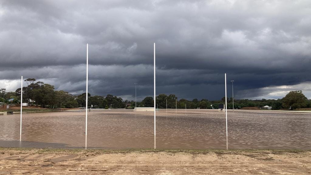
The predictive flood mapping is prepared using complex mathematical equations within computer generated models. These models convert historical rainfall, topography, drainage infrastructure and land use data into an estimate of the location, depth and velocity of flooding. These methodologies, known as RORB and TUFLOW, are widely used and accepted as the way to predict flooding.
The models are calibrated against previous flood events where flood levels have been documented. In the case of Wedderburn, surveyed flood marks are available for the November 2021 flood and the December 2023 flood.
Industry accepted climate change impact calculations have been included in the modelling.
An independent peer review will be conducted of the development of the mapping.
Project Introduction, August, 2025
Loddon Shire Council, in conjunction with the North Central Catchment Management Authority, has appointed HARC (Hydrology and Risk Consulting) Services Pty Ltd to complete the Wedderburn Flood Management Plan.
This project will involve modelling and analysis to define existing flood behaviour in and around Wedderburn, and the identification and evaluation of measures to mitigate and manage flood risk - including recommendations for flood planning overlays, mitigation works and infrastructure, updating the flood warning systems and emergency management plans.
The study is expected to take approximately 18 months, and once it is completed, Council will be able to make an informed decision about the best way to invest in flood management and mitigation in Wedderburn.
This project is funded by the Department of Energy, Environment and Climate Action (DEECA).
The project commenced in late July with the consultants beginning to collect information to inform their flood modelling.
A community drop in session was conducted on Tuesday 2nd September between 2pm and 6.30pm at the Loddon Shire Council Chambers, Wedderburn, to enable anyone who is interested to learn more about the project and to share local knowledge of flooding risks and impacts with HARC.
Following that session, HARC reviewed all information including previous flood events, rainfall, topography, existing infrastructure and climate predictions to develop modelling of flooding in Wedderburn under a range of scenarios. This modelling will be made available for community feedback, and will be used to develop mitigation options.

